We explain what maps are, their history, elements, types and uses. In addition, mental, cognitive and conceptual maps.
-
What are the maps?
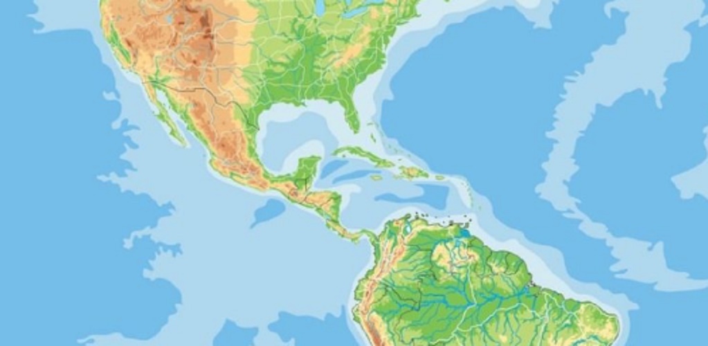
The maps are in general geographical, geopolitical or geological representations of the earth’s surface , which attempt to take note of the most representative, interesting or relevant elements of it, to serve as a document for researchers, explorers, tourists or specialists.
Maps are two-dimensional representations of a given territory, which can have different types of shapes: flat, spherical, etc. They offer relevant information in a set of signs, symbols, drawings and dimensions , depending on the specific approach in question.
For example, physical mapss have indications regarding relief , while geopolitical maps emphasize capitals, borders and political-historical relations.
Related to plans, sketches and other spatial graphic representations, mapss serve as a document to study and understand the geography of an area. They are also used to locate us from specific references within an unknown territory.
For this, the mapss obey a set of conventions regarding scale , limits and highlighted elements , depending on whether it is the map of a city , a cemetery or a subway.
-
History of the maps
The maps are as old as civilization itself. They arose as soon as the human being had the need to travel unknown or infrequent territories, either as part of exploration, trade or conquest initiatives .
The first maps of which one has a record date from ancient Mesopotamia , made in slats 5,000 years ago. But the first to be part of a formal cartographic initiative, that is, the first scientific mapss, come from classical Greco-Roman antiquity.
Thales of Miletus is credited with the first world map , which he conceived of the territories known at the time as a disk floating in the water. And to Ptolemy, centuries later, the first mapss that included meridians and parallels , useful for navigation and exploration.
The cartography and mapss had a real explosion at the end of the Middle Ages and the beginning of the Modern Era, when the great European adventurers and explorers such as Vasco Da Gama or Christopher Columbus took on the task of touring the seas.
This laid the foundations for the expansion of the colonial empires, such as Spain, the United Kingdom, France and Germany, which carried out important cartographic initiatives to be able to know, organize and distribute the colonized territories in America, Africa and Asia. This is why in Africa there are countries with completely straight borders, that is, artificially drawn.
Currently, there are interactive mapss powered by satellite services, thanks to which we can find ourselves in real time in any city in the world. Seen this way, the next frontiers to be drawn for cartography and mapss are located outside the planet, in the confines of the vast Solar System .
-
What are the maps for?

The maps serve to find our location in an unknown terrain . Together with a compass, they allow us to draw a navigation route, and depending on the type of map, they also provide us with pertinent information about where we are.
The pirates used mapss to remember where they had buried their loot. Architects and urban planners use them to study the growth of cities and plan urban design. The explorers use them to reach their destination, tourists to find their way to unknown cities and geologists to search for underground deposits. There are mapss for everything.
-
Elements of a map
Maps usually have at least the following elements:
- Title . The maps present titles that explain to the reader what the plane is observing.
- Source . Where the information displayed on the map was extracted or who created the map we are seeing.
- Plotted . The set of lines that represent geographical, urban, topographic borders, etc.
- Symbols . The set of marks and signs that make up the additional map information, such as cities, capitals, airports, etc. Of particular importance are those that indicate the cardinal orientation (where is the North, for example).
- Legend . A box in a corner of the map that explains what each symbol means that the reader will find on the map.
-
Types of maps
Depending on its specificity, there are different types of maps, such as:
- Physical mapss . They represent the earth’s surface, taking into account not only cities and human settlements, but also relief, hydrography and landforms.
- Political mapss . They represent the territory of a region, divided according to the existing borders of the nations, thus marking the boundaries between one and the other, specifying the location of its capitals and other data relevant to the world organization.
- Geological mapss . They show the earth’s crust and count their main deposits, geological substrates and other specialized information.
- Hydrological maps . They focus on the representation of rivers, lakes and seas, as well as groundwater deposits in the continental crust.
- City maps . They are maps of a city or a sector of it, in which the streets, services, tourist information, etc. are detailed.
-
Mental maps
Mind maps are a type of scheme or diagram used to represent a set of ideas , words or concepts that are linked together in a specific way. They use a set of lines, drawings or signs reminiscent of those on the mapss (hence their name).
Mind maps are an effective method to recall information or to transmit it graphically. However, sometimes they can be somewhat chaotic, because they obey the way in which the individual thinks about these issues, rather than the ideal way of transmitting them to a third party.
-
Conceptual maps
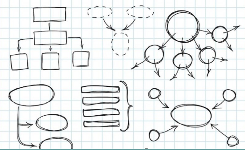
Concept maps are part of the learning techniques most used by students, to the extent that they allow them to create their own cognitive map of the subject they must learn. They organize the information according to importance, proximity, connection or any other objective or subjective criteria .
Learning with this type of techniques is considered among the methods of active learning, in which the student takes a leading role in the acquisition of knowledge, instead of a passive role in which he simply memorizes and repeats.
-
Cognitive maps
Cognitive maps are, in broad strokes, mind maps designed for the study or learning of a subject. They use a metaphorical visual content, useful to invite those who observe them to establish mnemonic links, to associate concepts and, ultimately, to learn.
They were introduced to teaching in 1948 by Edward Tolman , and since then they have not ceased to be used formally and informally.