We explain what is the Greenwich meridian and what is the history of this imaginary line. In addition, how the equator is located.
-
What is the Greenwich meridian?
It is known as Greenwich meridian, but also zero meridian, base meridian or first meridian, the imaginary vertical line that divides the world map into two identical halves and from which the lengths are measured. It is also the meridian that marks the world standard base time, which is added (GMT +) or subtracted (GMT-) hours to determine the planet’s time slots.
The location of this imaginary line gets its name because it crosses the British population of Greenwich , in England, and because there it was at the Royal Greenwich Observatory, built in 1675. However, the imaginary line crosses several countries in its path, and is Common to find in the United Kingdom, France, Spain, Algeria, Mali, Burkina Faso, Ghana, Togo and Antarctica signage marking their location.
This central meridian, whose crossing with the line of the equator divides the globe in four regions, is important in matters of geography and navigation , since it allows the existence of a network of coordinates that allows to encrypt a location in degrees and minutes.
Thus, the Greenwich meridian divides the planet into two semicircles of 180 ° each, segmented into time zones of 15 ° each (result of dividing 360 ° of the entire circumference by 24 hours).
In addition, the universal day (solar time) begins by convention at midnight in Greenwich, since the opposite line on the other side of the planet is considered the International Date Change Line.
-
History of the Greenwich Meridian
The adoption of this meridian as the basis for the time and coordinate system was taken in 1884 in Washington DC, United States, at a convention attended by delegates from 25 countries.
There the universalization of this system was agreed, since in different places different meridians were used as a guide . The resolution had the disapproval of countries such as the Dominican Republic and the abstentions of France and Brazil, but eventually it was imposed worldwide to date.
There is a very slight angular difference (5.3 seconds) between the Greenwich meridian and the reference meridian used by contemporary GPS systems, because in 1958 the first Global Satellite Positioning system was launched, whose greater precision in the 0 ° determination set them about 102 meters east of the Greenwich meridian.
-
Ecuador
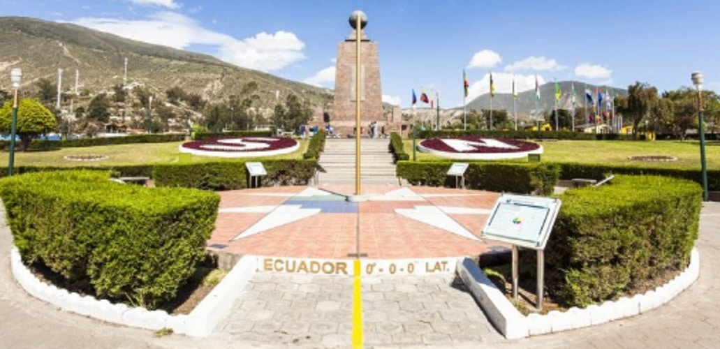
The equator is another imaginary line, which divides the planet Earth into two separate hemispheres: the north and the south , each with a different celestial vault. This line allows the drawing no longer of the meridians, but of the latitude lines, the parallels. In this sense, the equator would be the zero parallel or base parallel, whose circular shape traces the earth’s circumference in the tropics.
The equator crosses the territories of Ecuador (whose name comes precisely from that line), Colombia, Brazil, Sao Tome and Principe, Gabon, Republic of the Congo, Democratic Republic of the Congo, Uganda, Kenya, Somalia, Maldives (although not by its islands), Indonesia (the islands of Sumatra, Borneo, Celebes and Halmahera) and Kiribati.
The regions in which the parallels divide the earth from the equator are known as climatic strips, and mark the beginning and the end of the tropical, temperate and polar areas of the planet .
-
Latitude and longitude

Latitude and longitude are the components of the navigation system coordinates of the planet Earth used, among other things, for maps and for satellite or GPS positioning.
These are two sets of imaginary lines that cross the globe from north to south and from east to west , sectioning the surface of the planet in a regular grid, whose base axes are the Greenwich meridian (longitude 0) and the equator (latitude 0).
Using latitude and longitude, the Geographic Coordinates (latitude, longitude) of a given point on the planet’s surface can be assembled, for example: Spain is located at coordinates O 4 °, 0’00 ”(West four degrees, zero minutes , zero seconds) long and N 40 °, 0’00 ”(North forty degrees, zero minutes, zero seconds).